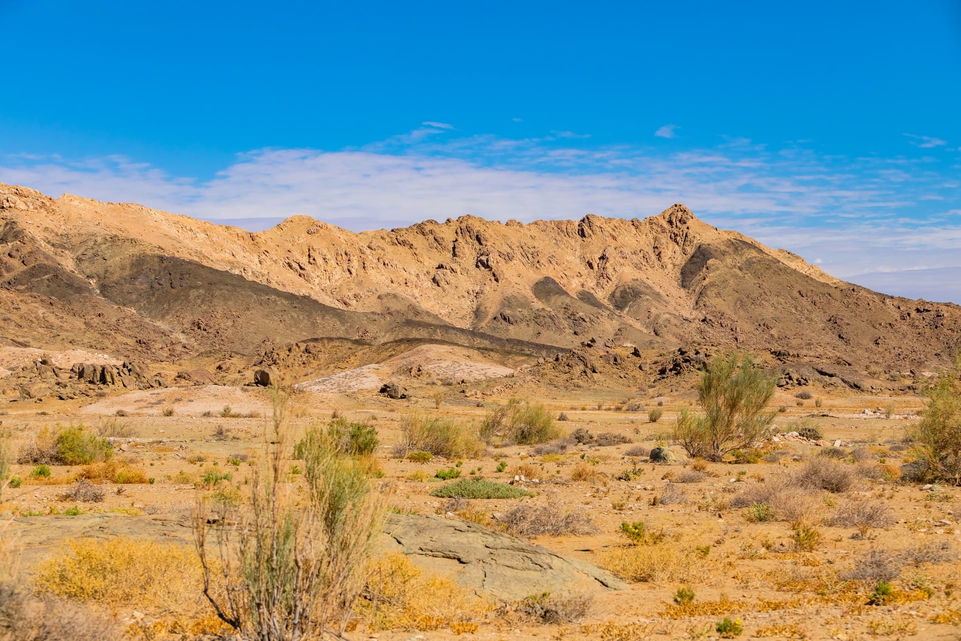
Richtersveld Desert
Richtersveld Desert
UNESCO site on the Namibian border, Richtersveld Desert combines endemic succulent flora, the Nama people, and mountainous desert accessible by 4x4.
Richtersveld Desert occupies the far northwest of South Africa, on the Namibian border marked by the Orange River. Inscribed on the UNESCO World Heritage list under the title Richtersveld Cultural and Botanical Landscape, this territory combines a mountainous desert of exceptional botanical density with the living tradition of semi-nomadic pastoral life among the Nama people. It is a demanding destination, accessible by 4x4, suited to travelers comfortable with self-sufficiency and long distances.
Why visit Richtersveld
Three characteristics set Richtersveld apart from other deserts in southern Africa.
- Exceptional botanical density: the area is home to one of the world's richest collections of succulent plants, including endemics such as Aloe dichotoma (quiver tree) and the halfmens ("half-human").
- Living cultural heritage: Richtersveld is, to researchers' knowledge, the only place where Haru Oms huts are still used daily by Nama communities.
- A transfrontier park: Richtersveld Transfrontier Park is the result of cooperation between South Africa and Namibia for joint conservation of the Orange River and its gorges.
The site is home to over 200 bird species and remains one of the few territories in South Africa where tourism pressure remains low.
What to see and do
The Nama people and Haru Oms huts
The Nama maintain a semi-nomadic lifestyle based on seasonal livestock transhumance. Their mobile architecture, passed down for centuries, relies on Haru Oms (called Matjieshuise in Afrikaans): a circular frame of green branches, planted in a circle then bent and tied with fine leather strips, on which woven reed mats are fixed. The ingenuity of the design lies in its thermal and waterproof properties: in summer, the mats allow air to circulate; in winter, the addition of hides retains heat; when it rains, the reeds swell on contact with water and seal the hut.
Visits take place in the Richtersveld Community Conservation Area (RCC), a protected area managed by local communities covering approximately 160,000 hectares of mountainous desert.
Endemic flora and spring flowering
Richtersveld is the heart of the Namaqualand succulent desert, one of the world's botanical hotspots. When winter rains are sufficient, the ground is covered with flowers between August and September — a phenomenon dependent on rainfall and therefore variable from year to year. In the absence of rain, moisture comes mainly from the morning mist locally called malmokkies, formed by Atlantic sea spray and penetrating inland at sunrise. Many plants and insects depend directly on it.
For a glimpse of rare endemics, the Sendelingsdrift nursery brings together protected species found nowhere else.
Hiking and trails
The Vensterval trail, spanning four days, departs from Hakiesdoring camp and successively crosses quartzite gorges, botterboom forests, the ridges of the Tswaies mountains and the Armanshoek springs. Several other shorter routes crisscross the park; confirm availability at reception upon entry.
Other notable points of interest:
- Halfmens Pass: scenic route where you can observe the halfmens succulents standing on the slopes.
- Sendelingsdrift: border post toward Namibia equipped with a pontoon that crosses the Orange River (Garib).
- "Hand of God": natural handprint on a rock face, associated with local legend.
- Picnicking along the Orange River, which marks the park's northern border.
- Stargazing: light pollution is virtually zero and the sky is particularly clear.
When to visit
The favorable season runs from May to September, during the southern winter, when daytime temperatures remain manageable. From October to April, summer heat frequently exceeds thresholds incompatible with hiking and off-road driving. If winter rains have been sufficient, spring flowering occurs between August and September — this is the most sought-after window and should be booked in advance.
Practical information
- Vehicle: a 4x4 is necessary to travel inside the park. Trails alternate between rocky passes and sandy riverbeds. Traveling in convoy (minimum two vehicles) is highly recommended.
- Self-sufficiency: provide adequate drinking water, food and fuel. No supplies available inside the park.
- Network coverage: very limited or absent in isolated areas. An emergency beacon or satellite phone may be useful.
- Accommodation: rustic campsites scattered throughout the park; more comfortable lodges at the reserve's gates, notably at Sendelingsdrift.
- Rates and hours: verify with SANParks at booking as they change.
How to get there
Richtersveld is remote from all major urban centers. The nearest international airport is Cape Town, located approximately 700–800 km to the south. Allow two days of travel to reach the reserve from Cape Town under comfortable conditions.
The classic road route follows the N7 northward to Steinkopf, then branches toward Port Nolloth and Alexander Bay. The final 80 kilometers are on dirt track. At Sendelingsdrift, a pontoon allows you to cross the Orange River to reach Namibia; check hours on site.
Nearby
Richtersveld lends itself to a logical combination with other South African stops, particularly those in the southwest, provided you accept long road journeys.
- Cape Peninsula — logical starting or ending point for a circuit including Richtersveld.
- Cape of Good Hope — coastal counterpart at the Cape, to pair with the peninsula.
- Zeitz Museum of Contemporary Art Africa — cultural stop at Cape Town before or after the desert.
- Sabi Sand Game Reserve — to combine desert and safari, at the opposite end of the country.
Frequently asked questions
Frequently asked questions
Yes. The park's interior trails combine rugged passes and sandy riverbeds. A vehicle with high ground clearance can access certain areas, but 4x4 remains essential for most routes.
The window falls between August and September, provided that winter rains have been sufficient. The phenomenon varies from year to year; it is better to check recent rainfall before planning your trip.
Yes, within the Richtersveld Community Conservation Area, managed by local communities. Meetings should be arranged through operators or the RCC, which ensures direct economic benefit for residents.
Plan for at least three to four days on site to explore the park's main sectors without rushing. The Vensterval trail alone takes four days.
Yes, at Sendelingsdrift, where a pontoon crosses the Orange River. The border post opening hours and pontoon availability should be checked before departure.
Preparing your trip
Richtersveld integrates well into a longer South African itinerary, complementing the classic stops at Cape Town and the Garden Route. To build a cohesive circuit including desert, mountains and safari, consult our South Africa tours.
Interested in this visit?
We can include it in your personalised itinerary.